Question: What is atmospheric dispersion modelling?
Answer: Atmospheric dispersion modelling is a computer-based technique used to predict how pollutants released from a source, such as a road, chimney, generator or industrial stack, travel and disperse through the atmosphere. The model calculates pollutant concentrations at defined receptor locations using emission rates, source characteristics, meteorological data, terrain and building geometry.
Dispersion modelling is widely used in UK planning and environmental permitting to demonstrate that a proposed development or process will not cause unacceptable concentrations of pollutants at homes, schools, hospitals, ecological sites and other sensitive receptors.
Question: When is dispersion modelling required?
Answer: Dispersion modelling is commonly required for:
- Air Quality Assessments where road traffic changes affect sensitive receptors
- Energy centres, CHP plant, biomass boilers and standby generators
- Industrial processes requiring an environmental permit
- Data centres with diesel generators
- Crematoria, hospitals and laboratories with flues
- Odour and bioaerosol assessments
- Assessing impacts on designated ecological sites such as SACs, SPAs and SSSIs
- Determining appropriate stack heights
Local Planning Authorities and the Environment Agency frequently expect modelling where simple screening cannot rule out a significant effect.
Question: What software is used for dispersion modelling?
Answer: The most commonly used models in the UK are ADMS (Atmospheric Dispersion Modelling System) developed by CERC, including ADMS-Roads and ADMS 6, and AERMOD developed by the US EPA. Both are accepted by the Environment Agency and Local Planning Authorities.
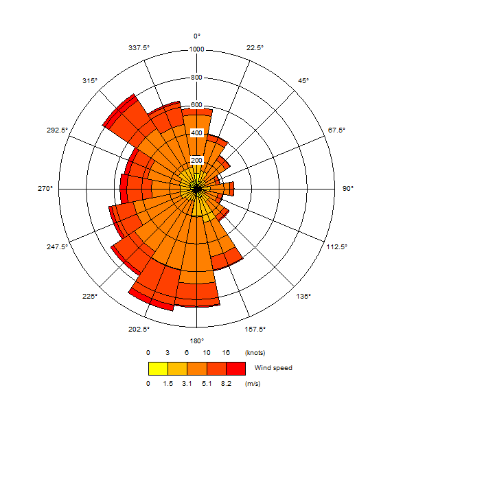
Models are configured with site-specific inputs including hourly meteorological data, surface roughness, building dimensions to account for downwash effects, and emission data derived from manufacturer specifications, traffic counts or the DEFRA Emissions Factor Toolkit.
Question: What pollutants can be modelled?
Answer: Dispersion modelling can assess almost any airborne pollutant, including nitrogen dioxide (NO2), nitrogen oxides (NOx), particulate matter (PM10 and PM2.5), sulphur dioxide, carbon monoxide, ammonia, volatile organic compounds, benzene, odour and bioaerosols. Deposition of nitrogen and acid to sensitive habitats can also be calculated for ecological assessments.
Question: How is dispersion modelling verified?
Answer: For road traffic modelling, DEFRA LAQM.TG(22) guidance requires the model to be verified against local monitoring data, typically diffusion tube or automatic monitoring results. An adjustment factor is derived to correct any systematic under- or over-prediction, improving confidence in the results.
For point source modelling, sensitivity tests are run using multiple years of meteorological data and a range of operating scenarios to ensure that the assessment is robust.
Question: What is a stack height assessment?
Answer: A stack height assessment uses dispersion modelling to determine the minimum chimney or flue height required to disperse emissions adequately and achieve acceptable ground-level concentrations. It considers building downwash effects, nearby receptors and the emission characteristics of the plant.
Stack height assessments are commonly required for energy centres, biomass installations, generators and industrial processes, and the Environment Agency and Local Planning Authorities may request them as part of a permit or planning application.
Question: How are the results of dispersion modelling reported?
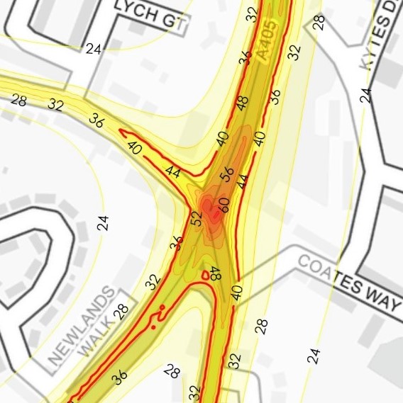
Answer: Results are presented as predicted concentrations at each receptor, compared against national air quality objectives and environmental assessment levels. Impact significance is described using IAQM and EPUK criteria for planning assessments, or Environment Agency screening criteria for permit applications. Contour plots are often provided to illustrate the spatial pattern of impacts.
The report sets out all inputs, assumptions and uncertainties so that reviewers can understand and rely on the findings.
Question: Why choose Syntegra Group for dispersion modelling?
Answer: Syntegra Group provides air quality dispersion modelling using ADMS and AERMOD for planning, environmental permitting and design optimisation projects across the UK. Our consultants have experience modelling road traffic, energy centres, generators, industrial stacks, odour and bioaerosols, and in verifying models against monitored data in line with DEFRA guidance.
As building services and energy specialists, we understand the plant being modelled and can work with design teams to adjust stack heights, plant selection and flue locations early, reducing risk and supporting a smooth planning and permitting process.